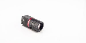
What Is a Remote Sensing Camera
A remote sensing camera is a specialized imaging tool designed to collect information about objects or areas without physical contact. These cameras capture electromagnetic radiation reflected or emitted from Earth’s surface, providing essential data for analysis and interpretation.

1. How Remote Sensing Cameras Work
Remote sensing cameras capture energy in various wavelengths, which helps to identify surface characteristics and environmental changes.
a. Imaging Process
-
Energy Source: Sunlight or artificial signals illuminate the target.
-
Detection: The camera captures reflected or emitted radiation.
-
Data Transmission: Captured images are sent to ground stations for analysis.
b. Types of Remote Sensing
-
Passive Remote Sensing: Captures natural radiation, such as visible or thermal infrared energy.
-
Active Remote Sensing: Uses its own energy source, like radar or LiDAR, to capture images even at night or through clouds.
2. Types of Remote Sensing Cameras
Remote sensing cameras vary based on the technology and wavelength they capture.
a. Optical Cameras
Optical cameras collect data in the visible and near-infrared spectrum, producing high-resolution imagery for mapping and monitoring.
b. Thermal Infrared Cameras
These cameras measure heat emitted by objects, useful for monitoring temperature changes and environmental studies.
c. Multispectral and Hyperspectral Cameras
-
Multispectral: Captures images in several discrete bands of the electromagnetic spectrum.
-
Hyperspectral: Collects data across hundreds of continuous bands, allowing for detailed material identification.
d. Synthetic Aperture Radar (SAR)
SAR cameras use microwave signals to capture high-resolution images, penetrating clouds and darkness for all-weather monitoring.
3. Applications of Remote Sensing Cameras
Remote sensing cameras are widely used across industries for scientific, environmental, and commercial purposes.
a. Environmental Monitoring
These cameras track deforestation, climate change, and water resource management by capturing and analyzing landscape changes.
b. Agriculture and Crop Analysis
Remote sensing helps monitor crop health, optimize irrigation, and assess soil quality through multispectral and thermal imagery.
c. Disaster Management
Satellite-based remote sensing cameras provide real-time imagery for detecting and responding to natural disasters like floods, earthquakes, and wildfires.
d. Urban Planning and Infrastructure
High-resolution imagery supports urban development, transportation planning, and infrastructure assessment.
4. Advancements in Remote Sensing Camera Technology
Technological innovations continue to enhance the performance and applications of remote sensing cameras.
a. Higher Resolution Imaging
Modern remote sensing cameras offer sub-meter resolution, enabling precise monitoring and analysis.
b. Real-Time Data Processing
Advanced systems provide near-instantaneous image capture and transmission for timely decision-making.
c. Miniaturized Sensors
Smaller, lighter cameras are increasing the accessibility of remote sensing on micro-satellites and drones.
Remote sensing cameras are transforming how we monitor and interact with the world. Their ability to capture detailed data across different spectral bands enhances applications in agriculture, environmental monitoring, and disaster response. As technology advances, these cameras will continue to play a critical role in providing accurate, real-time information for scientific and commercial use.
To explore more about advanced satellite imaging, visit our satellite platform knowledge section.
