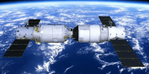
The remote sensing camera on the satellite uses the optical system to map the scenery on the earth to the image plane,and then converts it into digital signals for transmission and processing,so as to complete the Earth observation and monitoring task.
Its working principle can be roughly divided into the following steps:
1.Optical acquisition:Remote sensing cameras first gather light from the Earth through a lens system.Lenses can adjust the focal length and magnification ratio to better capture images.
2.Photoelectric conversion:After the light passes through the lens,it enters the photoelectric converter in the camera,which is generally a CCD or CMOS sensor.These sensors are made up of many tiny photosensitive elements that generate an electric charge when light hits them.
3.Signal amplification:After the photoelectric converter converts the optical signal into an electrical signal,it is necessary to increase the signal strength through an amplifier for subsequent processing.
4.Signal digitization:After signal amplification,enter the analog-to-digital converter to convert the signal to digital signal.These digital signals represent the brightness,color and other properties of the image.
5.Compression and encoding:Due to the large amount of image data generated by remote sensing cameras on satellites,compression and encoding are required to reduce the amount of data during transmission and storage.
6.Data transmission:The compressed and encoded image data can be transmitted to the ground station through the data transmission channel on the satellite.The transmission method can be radio waves,lasers,or microwaves,etc.
7.Image processing:The ground station decompresses and decodes the received image data,and performs image processing such as denoising,enhancement,correction,etc.to obtain clearer and more accurate images.

Common types of satellite remote sensing cameras:
1.Multi Spectral Camera:A multi spectral camera has multiple photosensitive devices in different bands,each corresponding to a different spectral range,such as visible light,infrared light,etc.This type of camera can provide rich surface information and is widely used in fields such as agriculture,forests,and water resource management.Some common multi spectral camera models include Landsat TM,Landsat ETM+,MODIS,etc.
2.Hyperspectral Camera:Hyperspectral cameras can perform high-precision spectral analysis of electromagnetic waves reflected from the ground,with a much larger number of bands than multi spectral cameras.Through hyperspectral technology,rich spectral information can be obtained for use in geological exploration,environmental protection,military reconnaissance,and other fields.Some common hyperspectral camera models include AVIRIS Hyperion et al.
3.SAR(Synthetic Aperture Radar):SAR cameras use radar technology to obtain image information of the Earth’s surface using microwave signals.Unlike optical cameras,SAR cameras are not limited by weather and lighting conditions and can achieve all-weather and all-weather remote sensing observations.SAR cameras are widely used in fields such as seismic geology,ocean monitoring,and surface deformation.Some common SAR camera models include ERS,TerraSAR-X,SENTINEL-1,etc.
Overall,remote sensing cameras on satellites use optical systems to capture and convert light from Earth into electrical signals,which are then amplified,digitized,compressed,and encoded before being transmitted to ground stations for decoding and image processing.In this way,high-resolution and high-quality images of the Earth can be obtained.
